Satellite Imagery and UAV Mapping
We combine satellite imagery and UAV mapping to capture site conditions, detect change, inspect assets, and build reliable geospatial layers for Saudi projects.
EnmaTech provides Earth Observation solutions in Saudi Arabia using satellite imagery, UAV data, GIS mapping, remote sensing, thermal analysis, and geospatial analytics for environmental, urban, infrastructure, and industrial decisions.
EnmaTech provides Earth Observation solutions in Saudi Arabia using satellite imagery, UAV data, GIS mapping, remote sensing, thermal analysis, and geospatial analytics. Our services help government entities, developers, environmental consultants, industrial operators, municipalities, and infrastructure projects monitor environmental risks, detect changes, assess hazards, and make data-driven decisions.
Our Earth Observation solutions cover flood risk mapping, oil spill detection, wildfire detection, urban heat island mapping, land subsidence monitoring, coastal monitoring, vegetation analysis, tower inspection, facility heat loss assessment, and Ground Penetrating Radar services. These outputs can support Environmental Impact Assessment in Saudi Arabia, environmental baseline studies, hydrological risk reviews, and environmental compliance reporting.
Satellite, UAV, GIS and field context.
Remote sensing indicators and spatial models.
Decision-ready layers and priority zones.
Clear outputs for planning and operations.
A clearer view of field conditions, environmental risks, and infrastructure change through satellite imagery, UAV mapping, GIS, and targeted analytics.
We combine satellite imagery and UAV mapping to capture site conditions, detect change, inspect assets, and build reliable geospatial layers for Saudi projects.
GIS mapping turns remote sensing outputs into decision-ready maps, risk zones, dashboards, and reports that support planning, operations, permitting, and environmental monitoring.
eFlood supports flood risk mapping, high-risk zone identification, drainage review, and emergency planning using Earth Observation, weather data, terrain information, and spatial modelling.
Satellite imagery and targeted analytics can help detect oil spill signatures, monitor coastal and offshore pollution risks, and support faster response decisions.
Thermal mapping identifies urban heat islands, surface temperature patterns, building heat loss, and cooling opportunities for cities, facilities, and infrastructure corridors.
Satellite-based deformation monitoring helps track land subsidence, settlement trends, and infrastructure risk for urban areas, utilities, roads, and development sites.
Fire Finder combines remote sensing and UAV data to detect heat anomalies, active fire areas, burn scars, and post-event environmental impacts.
GPR services support non-destructive subsurface scanning for utilities, concrete reinforcement, voids, pavement layers, and shallow subsurface anomalies.
Earth Observation can strengthen environmental baseline studies, EIA documentation, construction monitoring, coastal monitoring, vegetation analysis, and compliance reporting.
EnmaTech connects Earth Observation, environmental assessment, hydrology, GIS, UAV mapping, thermal analysis, and GPR services into practical workflows for Saudi project teams.
Each service can be delivered as a one-time assessment or as a recurring monitoring workflow, depending on the operational need.
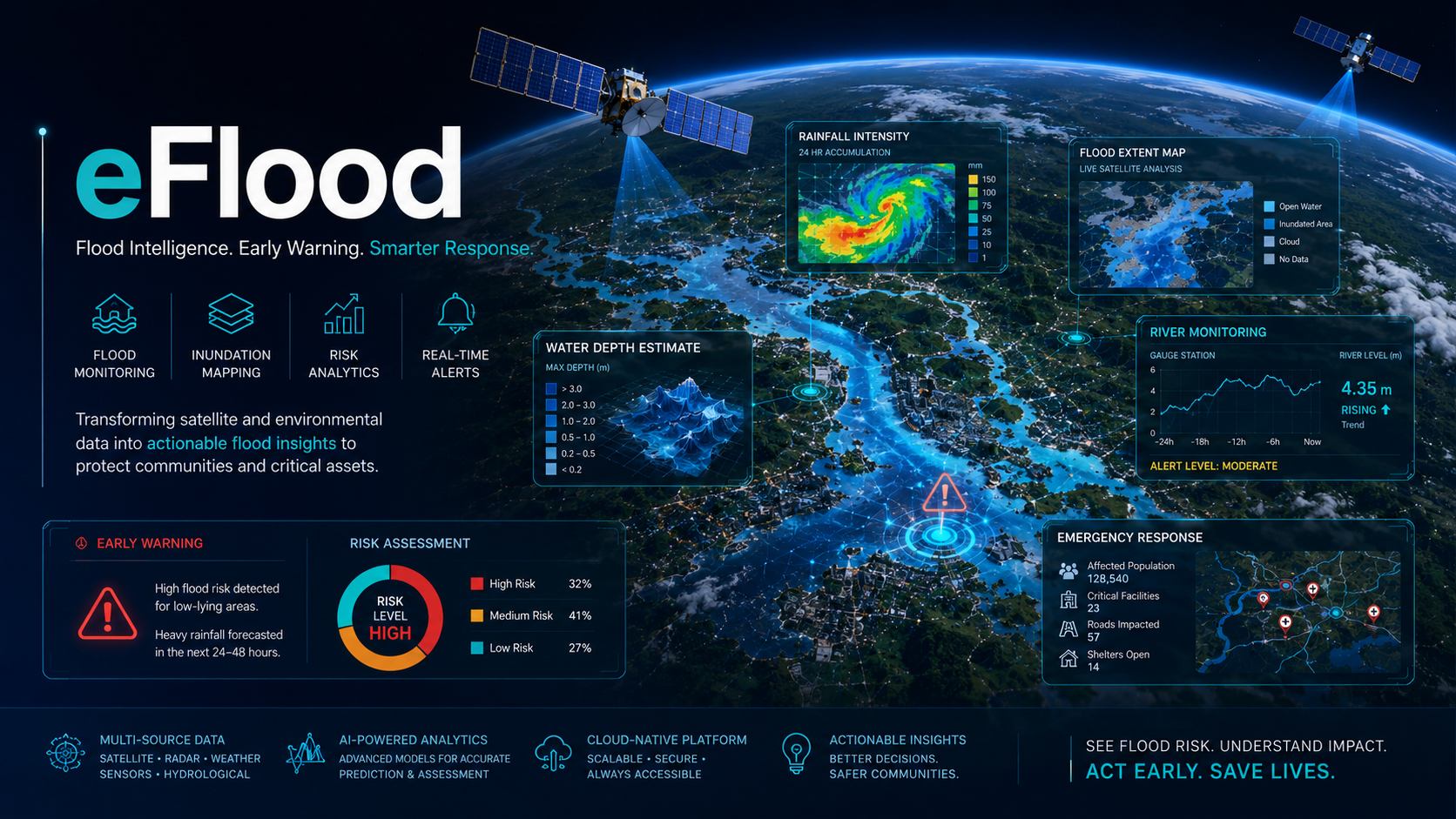
Smart flood forecasting and impact intelligence that combines Earth observation, weather information and modelling to help agencies anticipate high-risk zones.
View service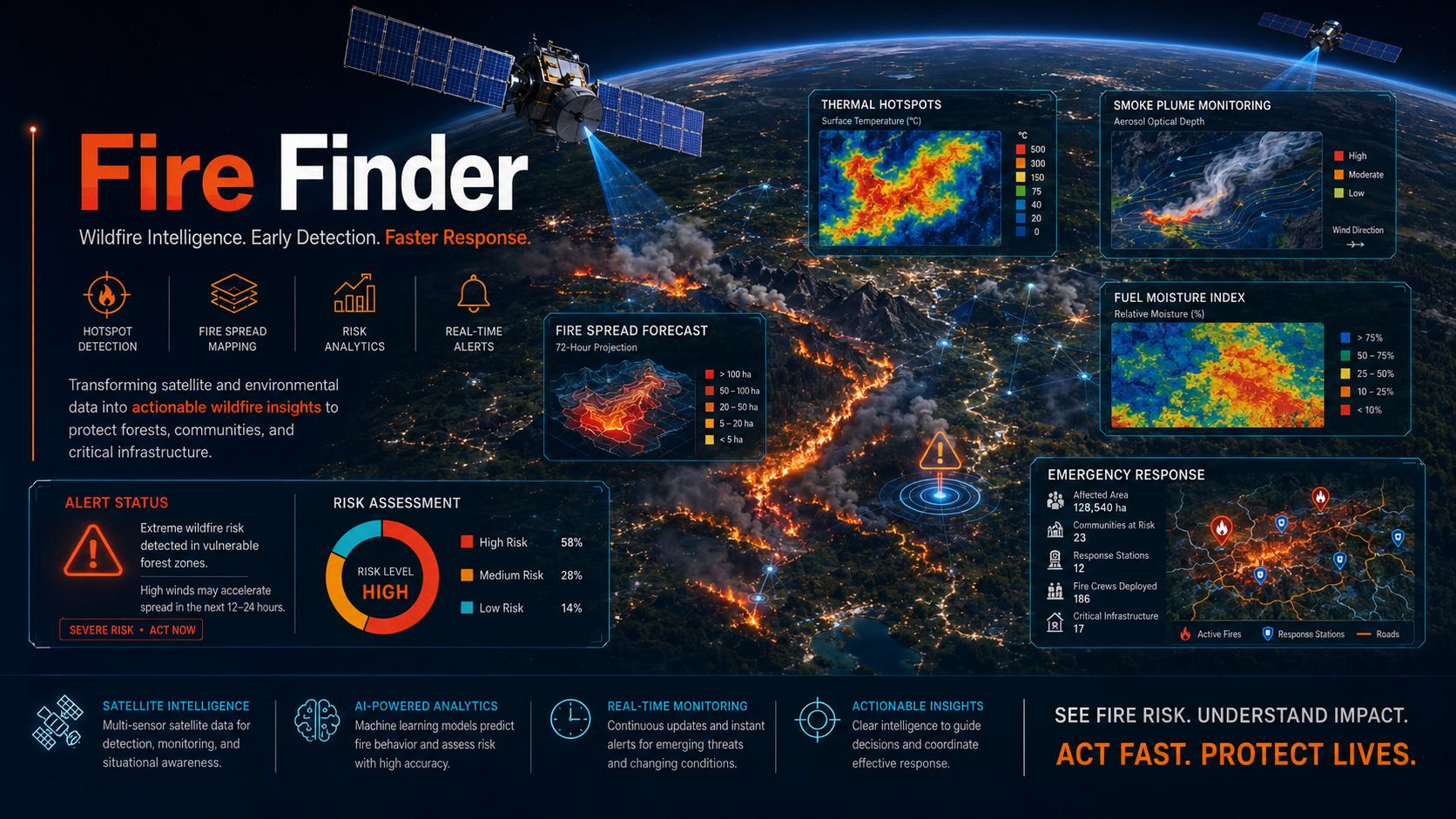
Remote sensing and drone-supported fire detection for rapid identification of heat anomalies, active fire fronts and post-event burn scars.
View service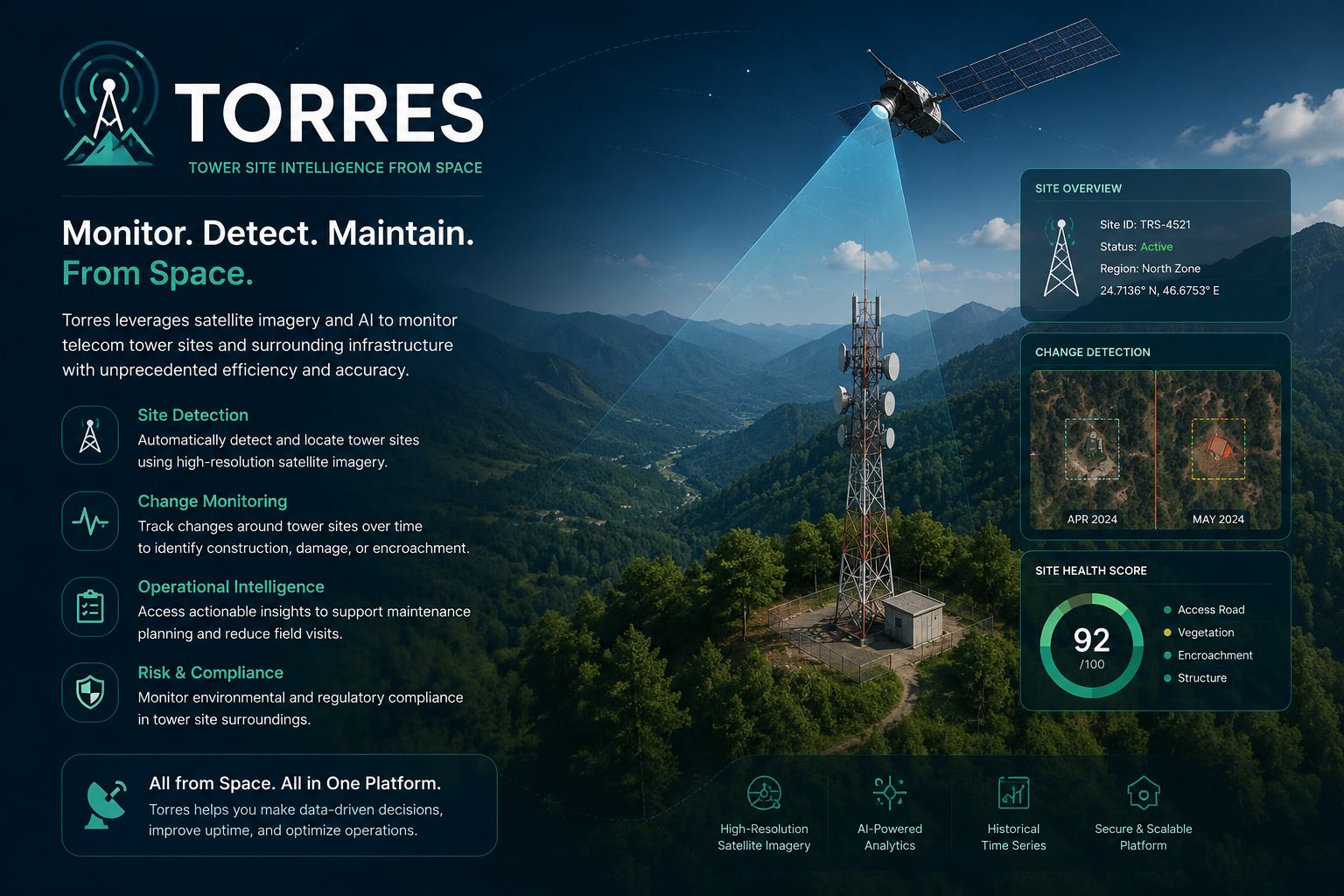
Automated inspection intelligence for towers and linear infrastructure using satellite data, UAV imagery and digital reporting workflows.
View service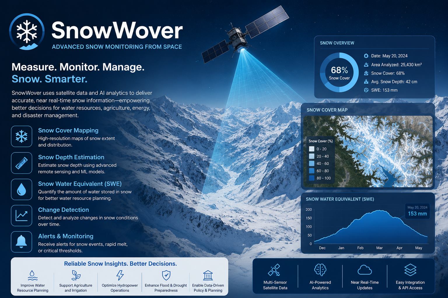
Snow, ice and mountain water resource monitoring for hydrological analysis, route safety and seasonal planning.
View service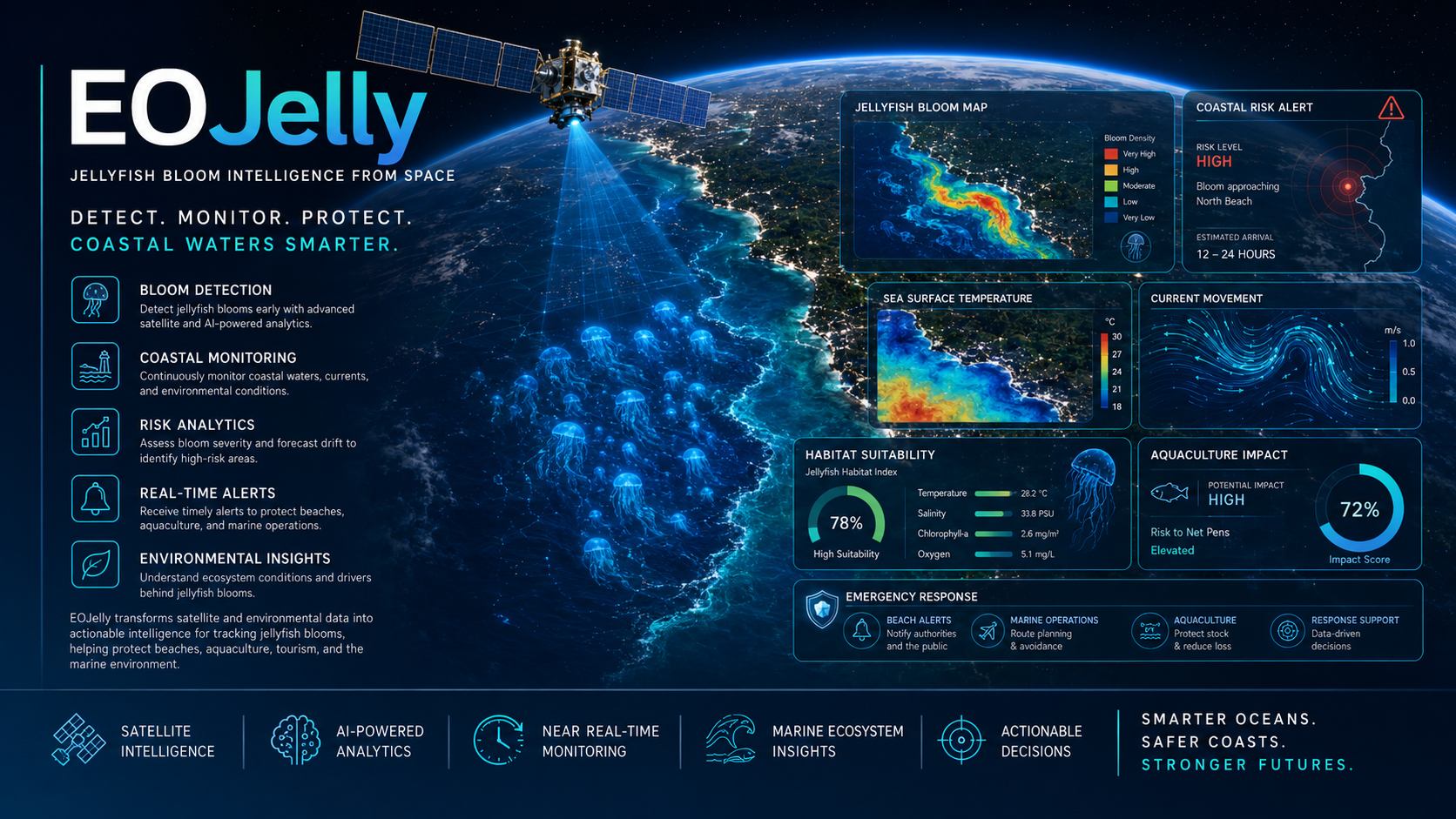
Coastal and marine Earth observation analytics for jellyfish bloom awareness, water quality signals and operational beach or facility risk.
View service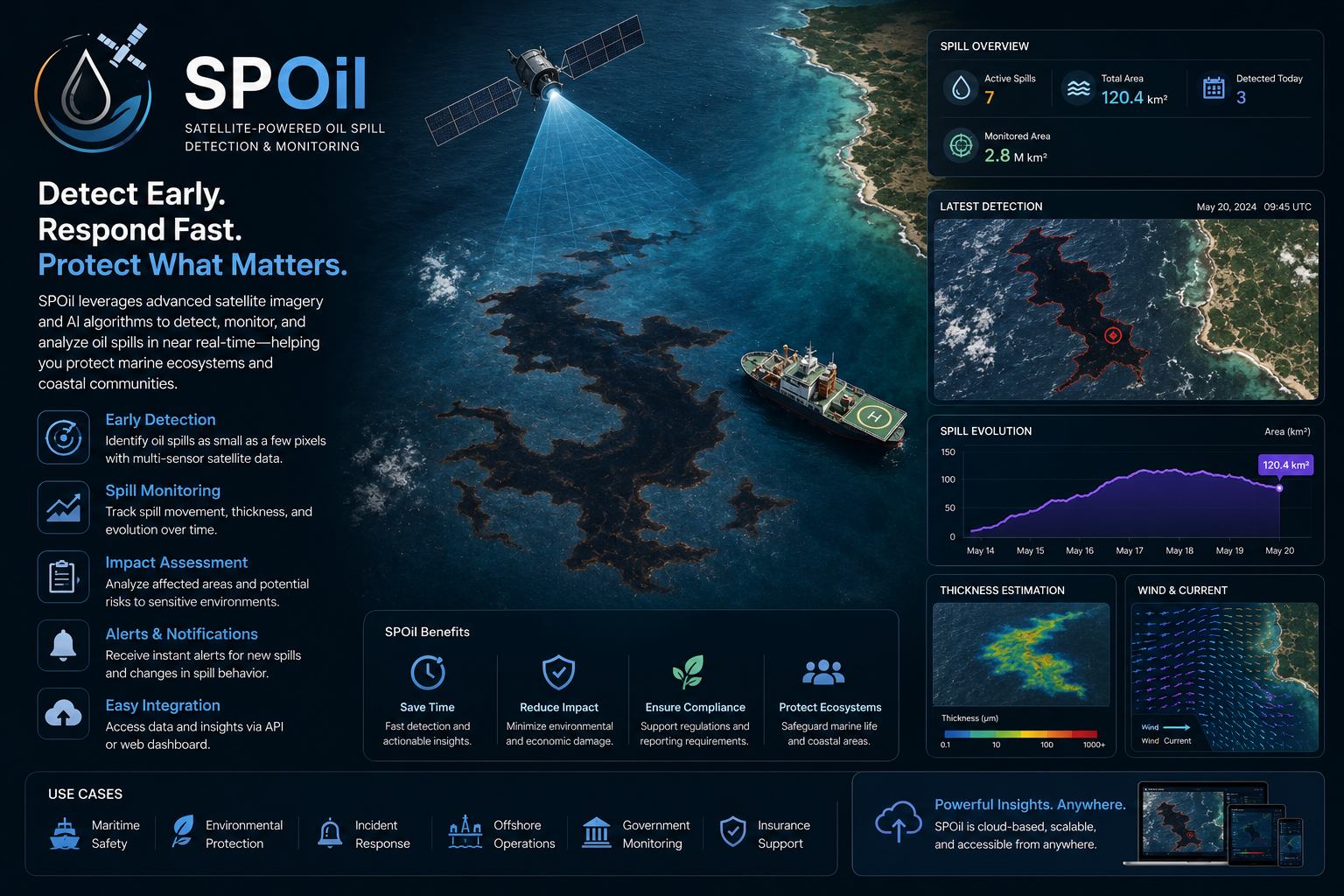
Oil spill detection and marine pollution intelligence using satellite imagery and targeted analytics for coastal and offshore response.
View service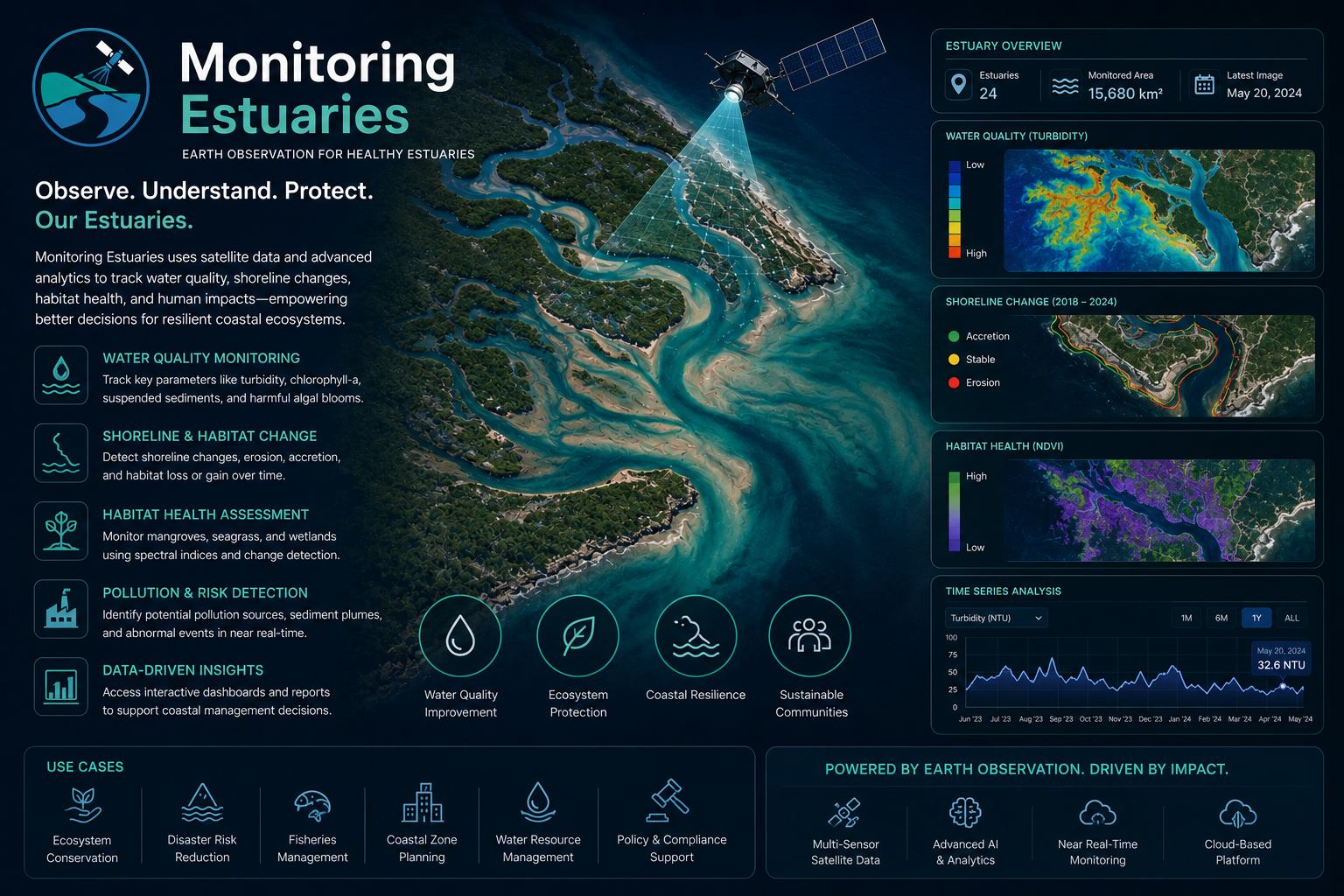
Estuary and coastal wetland monitoring that tracks sediment, vegetation, land-water boundaries and ecological change over time.
View service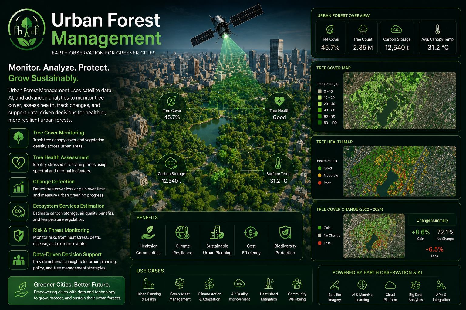
Urban tree canopy and vegetation intelligence for healthier cities, better asset inventories and measurable green infrastructure planning.
View service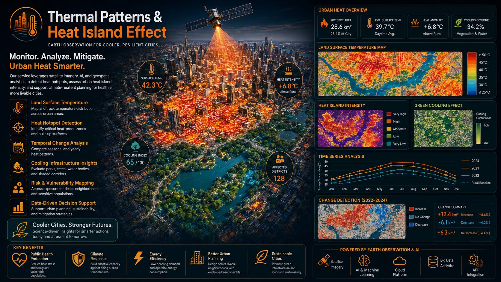
Thermal satellite analytics that identify urban heat islands, surface temperature patterns and cooling opportunities in built environments.
View service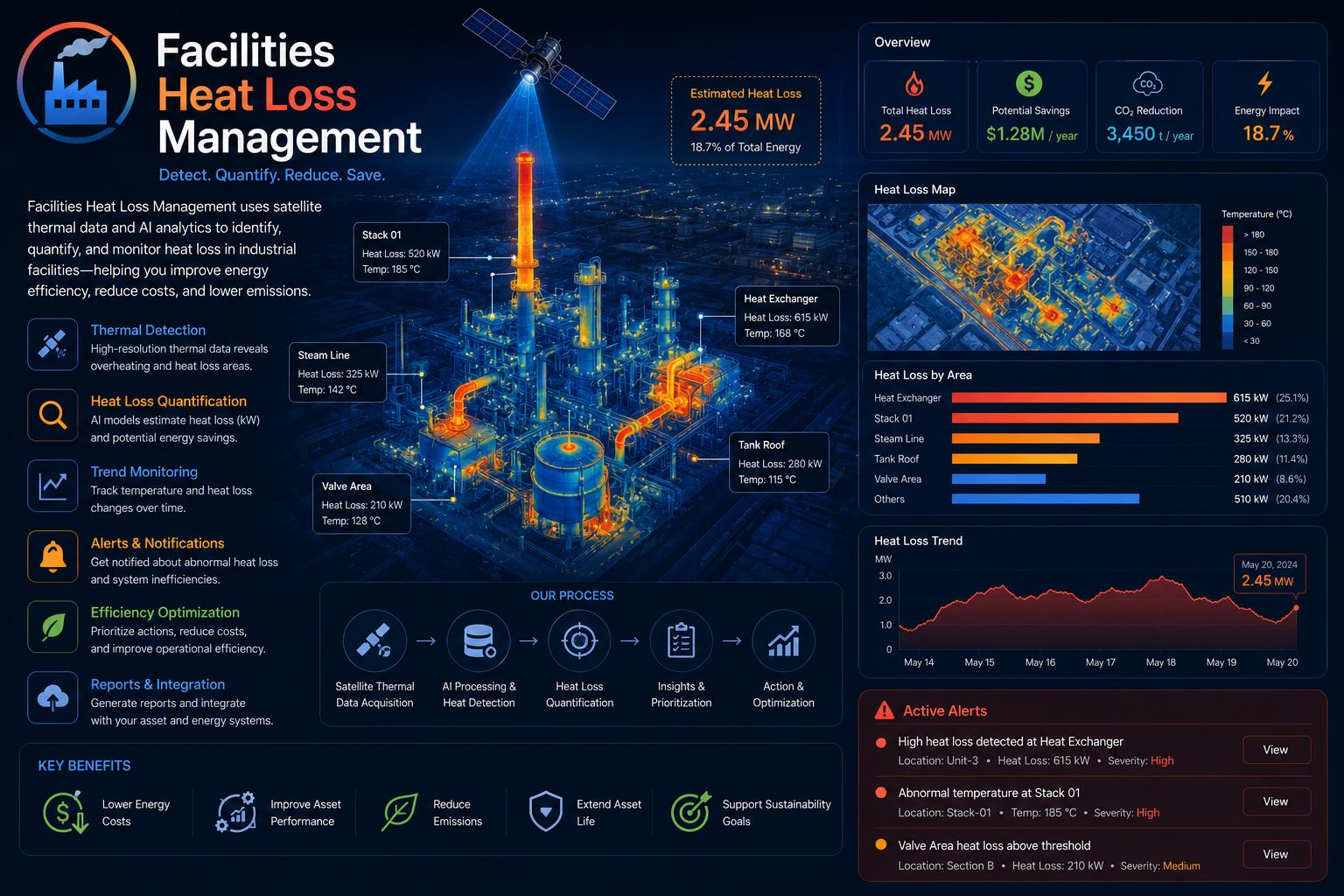
Thermal inspection analytics for buildings and facilities that reveal heat loss, insulation weaknesses and energy efficiency opportunities.
View service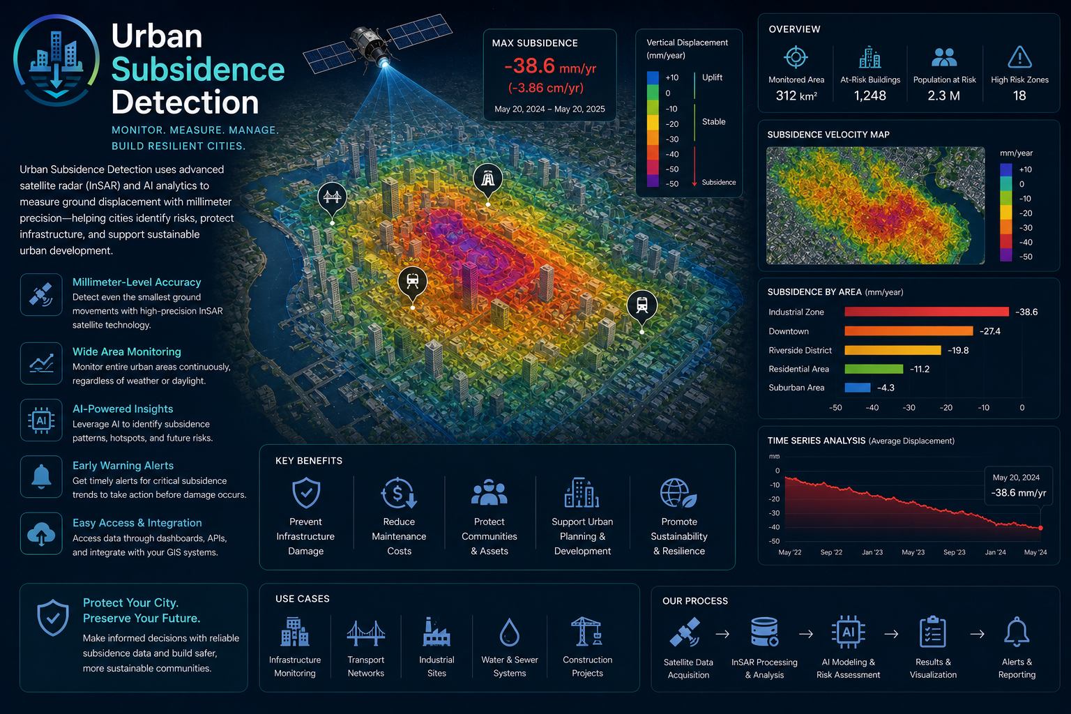
Satellite-based deformation monitoring for urban subsidence, settlement trends and infrastructure risk management.
View service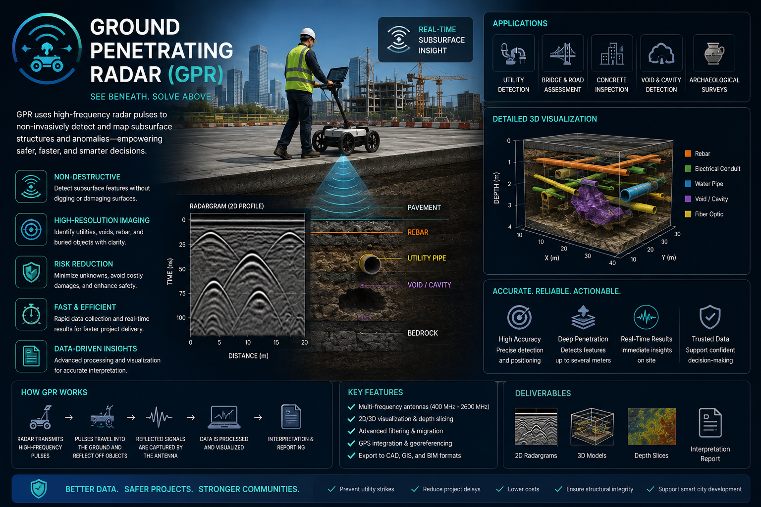
Non-destructive scanning for buried utilities, concrete reinforcement, voids, pavement layers and shallow subsurface anomalies.
Ground Penetrating Radar Services Saudi ArabiaWe can combine multiple services into a single dashboard or reporting package for your area of interest.
EnmaTech also connects Earth Observation with biosecurity, sustainability and green environment solutions for biodiversity monitoring, habitat restoration and resource-efficiency programs.