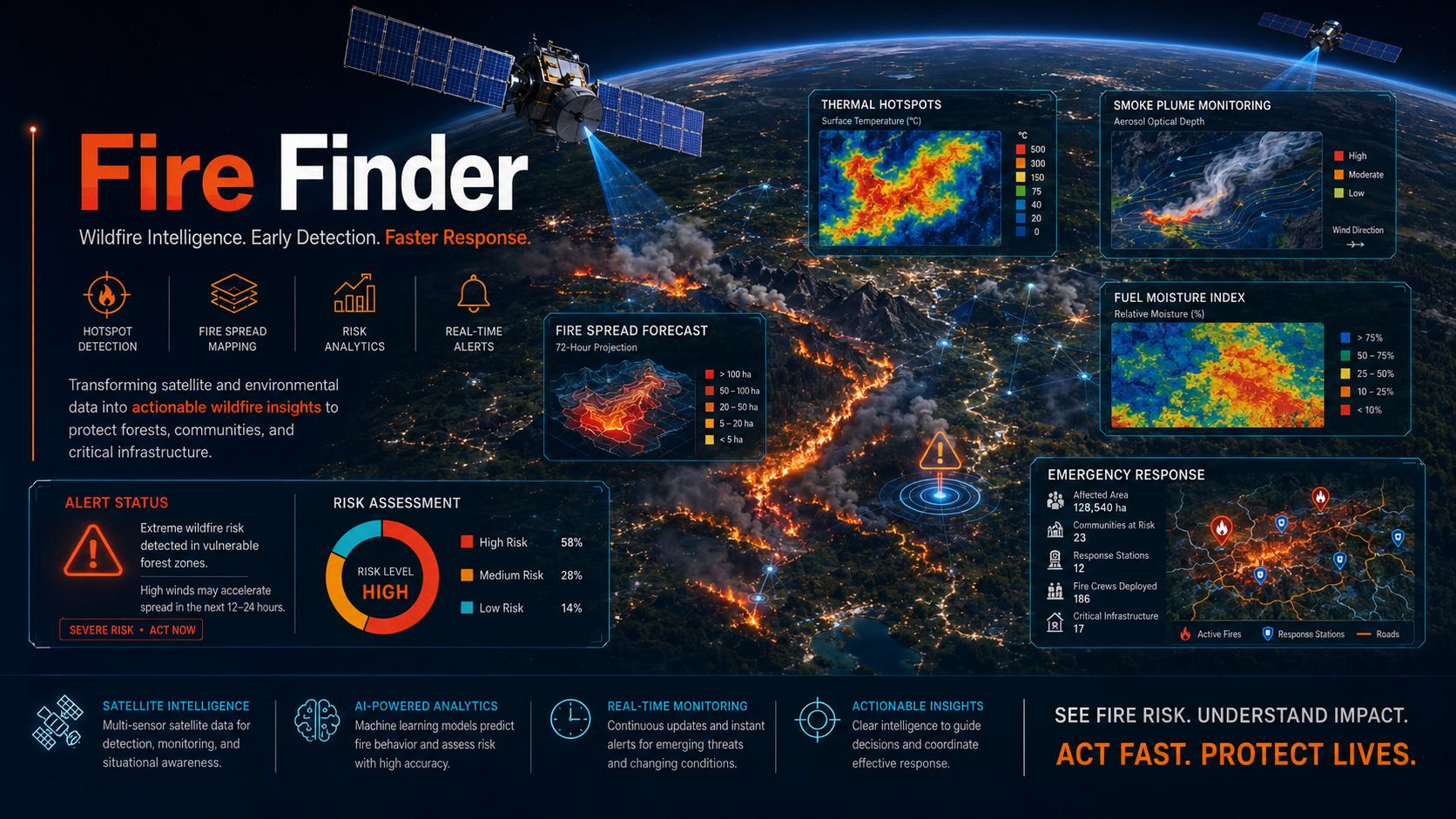
Wildfire Detection Saudi Arabia
Remote sensing and drone-supported fire detection for rapid identification of heat anomalies, active fire fronts and post-event burn scars.
What Fire Finder helps you do
Fire Finder helps teams detect, understand and document fire events across forests, open land, industrial zones and utility corridors. The service uses thermal and optical indicators to highlight active fire signatures, smoke affected areas and burn scars, giving decision makers a practical view of where attention is needed first.
EnmaTech combines satellite monitoring, UAV imagery where needed and geospatial analysis to produce fire intelligence layers. The outputs can support early response, field team routing, damage assessment and environmental reporting after the event.
Typical deliverables
- Active fire and heat anomaly maps
- Burn scar and affected area analysis
- Before and after satellite comparison
- Operational map package for response teams
Applications
- Wildfire surveillance
- Civil protection operations
- Industrial and utility corridor monitoring
- Burn scar assessment
Benefits
- Earlier detection of active fires
- Improved response prioritization
- Reduced inspection time
- Actionable thermal and optical evidence
A clear workflow from data to action
The workflow can be adapted for one-time studies, monthly monitoring, event response or long-term operational reporting.
Scope the area
Define assets, boundaries, risks, frequency and reporting needs.
Process data
Use satellite, UAV, GIS and contextual data to extract indicators.
Validate insights
Review outputs against project context and available field information.
Deliver outputs
Provide maps, GIS layers, dashboards or reports for decision makers.
Plan a Fire Finder assessment
Share your area of interest and monitoring objective, and EnmaTech can prepare a suitable Earth observation workflow.