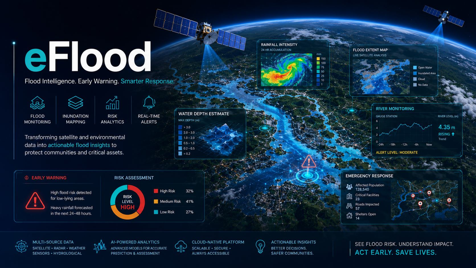
Flood Risk Mapping Saudi Arabia
Smart flood forecasting and impact intelligence that combines Earth observation, weather information and modelling to help agencies anticipate high-risk zones.
What eFlood helps you do
eFlood supports flood preparedness before, during and after severe rainfall events. It combines satellite observations, rainfall information, elevation context and geospatial modelling to identify flood-prone zones, exposed assets and priority intervention areas. The service is designed for municipalities, emergency teams, infrastructure owners and insurers that need fast, map-based intelligence instead of scattered reports.
The workflow starts by defining the catchment, assets and monitoring area, then combines optical, radar and terrain data with hydrological indicators. EnmaTech prepares risk layers, flood extent maps, impact zones and clear reporting outputs that can be used for planning, response and post-event documentation.
Typical deliverables
- Flood risk and exposure maps
- Satellite based flood extent layers
- Priority zones for response teams
- Technical summary report with GIS outputs
Applications
- Flood hazard mapping
- Emergency response planning
- Infrastructure and road protection
- Insurance and municipal risk analysis
Benefits
- Rapid situational awareness
- Better preparation before severe rainfall
- Clear maps for decision makers
- Scalable monitoring across large areas
A clear workflow from data to action
The workflow can be adapted for one-time studies, monthly monitoring, event response or long-term operational reporting.
Scope the area
Define assets, boundaries, risks, frequency and reporting needs.
Process data
Use satellite, UAV, GIS and contextual data to extract indicators.
Validate insights
Review outputs against project context and available field information.
Deliver outputs
Provide maps, GIS layers, dashboards or reports for decision makers.
Plan a eFlood assessment
Share your area of interest and monitoring objective, and EnmaTech can prepare a suitable Earth observation workflow.