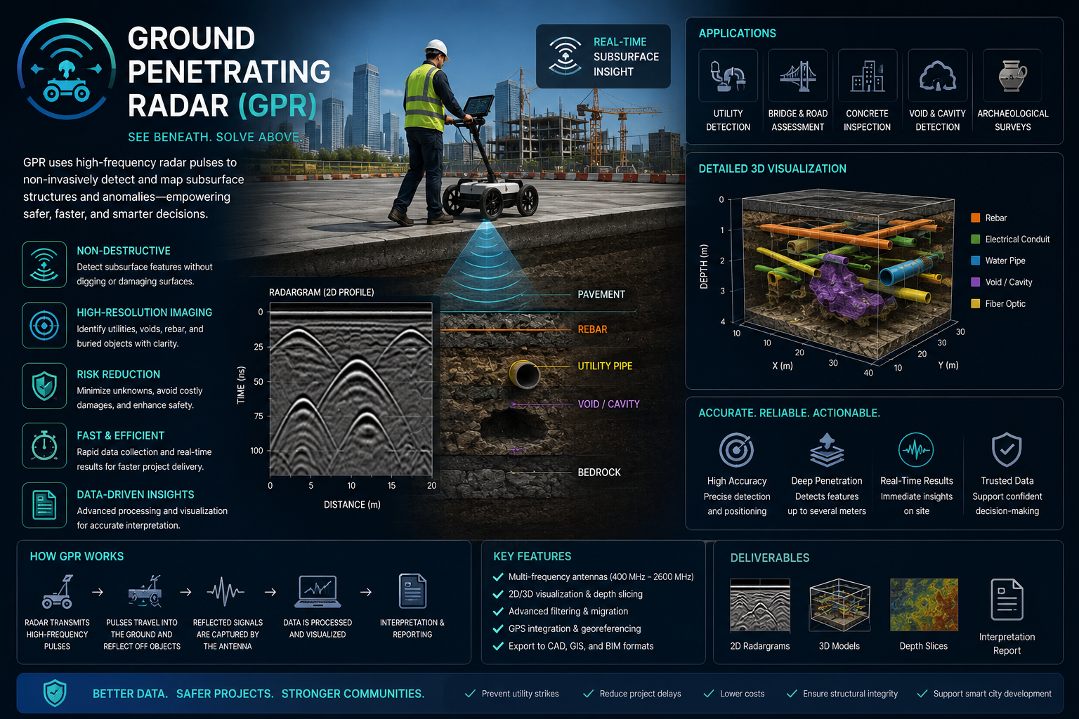
Ground Penetrating Radar Services Saudi Arabia
Non-destructive scanning for buried utilities, concrete reinforcement, voids, pavement layers and shallow subsurface anomalies.
What GPR helps you do
Ground Penetrating Radar gives project teams a fast, non-destructive way to understand shallow subsurface conditions before excavation, coring, cutting or rehabilitation work begins. It is useful for utility detection, concrete scanning, void screening and pavement assessment.
EnmaTech plans the scan area, collects radar profiles, interprets detected targets and prepares practical outputs for engineering, construction and facility teams. Results can be combined with drawings, site observations and verification pits where required.
Typical deliverables
- On-site target markings
- Interpreted GPR profiles
- Utility and anomaly maps
- Technical report with limitations
Applications
- Buried utility detection
- Concrete slab and rebar scanning
- Void and cavity screening
- Pavement and shallow layer assessment
Benefits
- Reduce excavation and coring risk
- Support safer field decisions
- Screen large areas quickly
- Document subsurface uncertainty clearly
A clear workflow from scan to action
The workflow can be adapted for pre-excavation surveys, concrete cutting checks, pavement investigations or asset condition studies.
Scope the scan
Define the area, expected targets, access limits and reporting needs.
Collect profiles
Run GPR survey lines and record radar responses across the target zone.
Interpret targets
Review reflections, site context and available drawings to classify findings.
Deliver outputs
Provide markings, maps, interpreted profiles and recommendations.
Plan a GPR assessment
Share your site, drawings and survey objective, and EnmaTech can prepare a suitable GPR workflow.