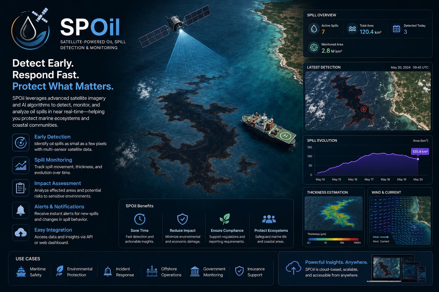
Oil Spill Detection Saudi Arabia
Oil spill detection and marine pollution intelligence using satellite imagery and targeted analytics for coastal and offshore response.
What SPOil helps you do
SPOil supports the detection and documentation of potential oil spills and marine pollution events. It is designed for environmental agencies, port operators, offshore facilities and response teams that need fast evidence over wide marine areas.
The service uses satellite imagery, spectral analysis and geospatial interpretation to highlight suspicious slicks and affected zones. EnmaTech prepares maps and reports that help teams coordinate response, document incidents and support compliance workflows.
Typical deliverables
- Potential spill detection maps
- Affected coastline and offshore layers
- Incident evidence package
- Environmental response report
Applications
- Oil spill detection
- Coastal protection
- Offshore facility monitoring
- Environmental incident reporting
Benefits
- Wide-area marine surveillance
- Faster response coordination
- Documented spill evidence
- Support for compliance and reporting
A clear workflow from data to action
The workflow can be adapted for one-time studies, monthly monitoring, event response or long-term operational reporting.
Scope the area
Define assets, boundaries, risks, frequency and reporting needs.
Process data
Use satellite, UAV, GIS and contextual data to extract indicators.
Validate insights
Review outputs against project context and available field information.
Deliver outputs
Provide maps, GIS layers, dashboards or reports for decision makers.
Plan a SPOil assessment
Share your area of interest and monitoring objective, and EnmaTech can prepare a suitable Earth observation workflow.