Coastal and Estuary Monitoring Saudi Arabia
Estuary and coastal wetland monitoring that tracks sediment, vegetation, land-water boundaries and ecological change over time.
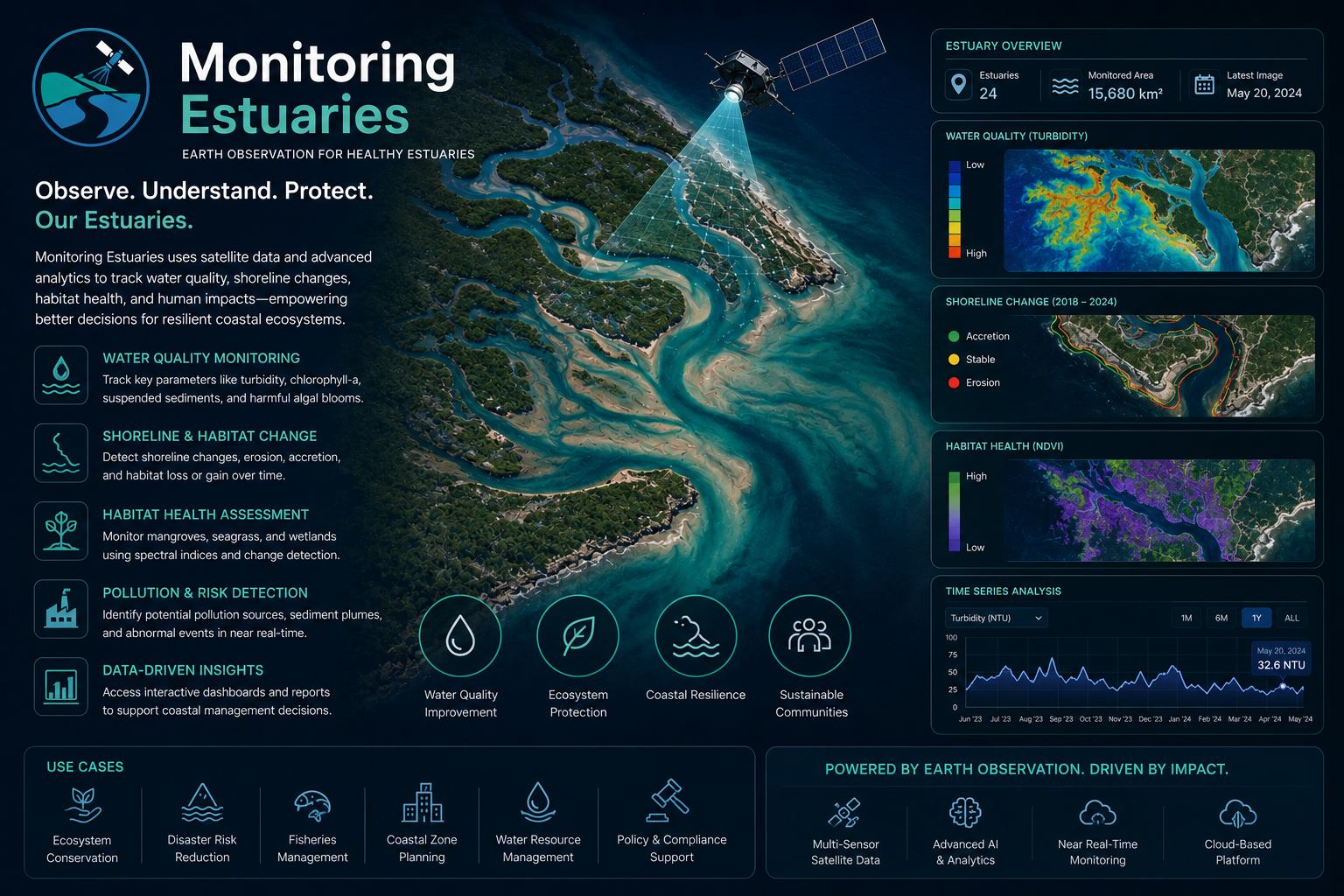
What Monitoring Estuaries helps you do
Monitoring Estuaries gives coastal managers a repeatable way to understand dynamic environments where river, sea and development pressures meet. It helps track sediment movement, vegetation health, shoreline change, turbidity and land-water transitions.
EnmaTech builds a multi-date monitoring workflow using satellite archives, recent imagery and GIS analysis. Outputs are prepared for planning, conservation, development review and long-term environmental reporting.
Typical deliverables
- Estuary change detection maps
- Sediment and turbidity indicators
- Habitat and vegetation layers
- Coastal monitoring report
Applications
- Sediment and turbidity tracking
- Wetland change monitoring
- Coastal development assessment
- Habitat and ecosystem reporting
Benefits
- Repeatable change detection
- Reduced field survey effort
- Historical comparison from satellite archives
- Maps for coastal decision makers
A clear workflow from data to action
The workflow can be adapted for one-time studies, monthly monitoring, event response or long-term operational reporting.
Scope the area
Define assets, boundaries, risks, frequency and reporting needs.
Process data
Use satellite, UAV, GIS and contextual data to extract indicators.
Validate insights
Review outputs against project context and available field information.
Deliver outputs
Provide maps, GIS layers, dashboards or reports for decision makers.
Plan a Monitoring Estuaries assessment
Share your area of interest and monitoring objective, and EnmaTech can prepare a suitable Earth observation workflow.