Land Subsidence Monitoring Saudi Arabia
Satellite-based deformation monitoring for urban subsidence, settlement trends and infrastructure risk management.
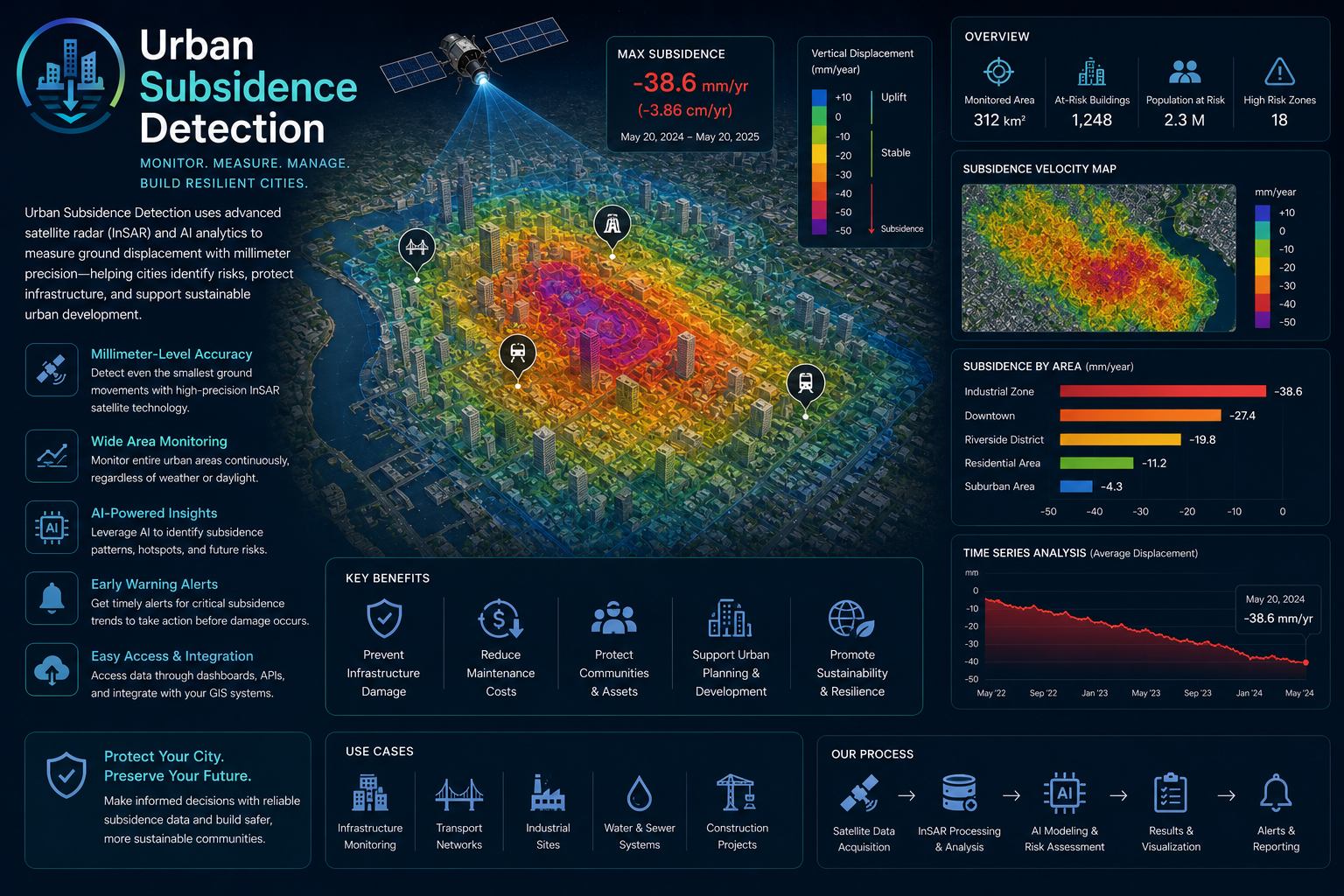
What Urban Subsidence Detection helps you do
Urban Subsidence Detection helps engineering, construction and municipal teams monitor ground movement that may affect roads, buildings, utilities and major infrastructure. The service is especially valuable in areas exposed to groundwater change, tunneling, reclamation, construction loading or natural settlement.
EnmaTech uses satellite deformation monitoring and GIS analysis to identify movement patterns and priority areas. The outputs help teams understand where field verification is needed and how displacement evolves through time.
Typical deliverables
- Ground deformation maps
- Movement trend analysis
- Infrastructure risk zones
- Subsidence monitoring report
Applications
- Urban deformation monitoring
- Infrastructure risk assessment
- Construction and tunneling impact review
- Long-term settlement tracking
Benefits
- Millimetric movement insights
- Historical trend analysis
- Early warning support
- Reduced reliance on broad field campaigns
A clear workflow from data to action
The workflow can be adapted for one-time studies, monthly monitoring, event response or long-term operational reporting.
Scope the area
Define assets, boundaries, risks, frequency and reporting needs.
Process data
Use satellite, UAV, GIS and contextual data to extract indicators.
Validate insights
Review outputs against project context and available field information.
Deliver outputs
Provide maps, GIS layers, dashboards or reports for decision makers.
Plan a Urban Subsidence Detection assessment
Share your area of interest and monitoring objective, and EnmaTech can prepare a suitable Earth observation workflow.