Snow Monitoring and Hydrological Analysis
Snow, ice and mountain water resource monitoring for hydrological analysis, route safety and seasonal planning.
What SnowWover helps you do
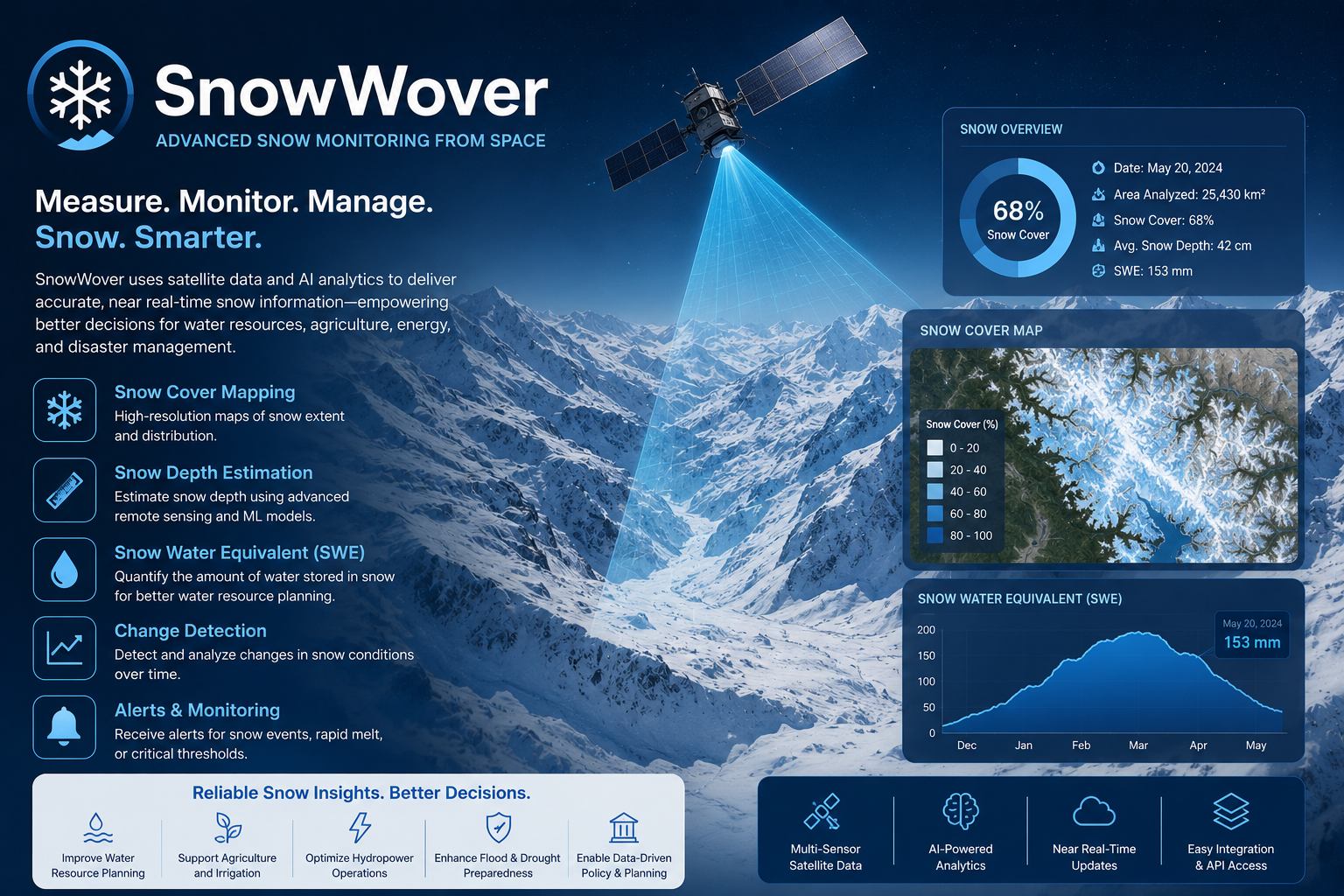
SnowWover provides regular insight into snow cover, ice conditions and mountain water resources. It is useful for hydrology teams, road authorities, tourism operators and environmental agencies that need to understand remote highland conditions without relying only on field observation.
The service uses multi-date satellite imagery and terrain context to map snow extent, seasonal persistence and potential risk zones. EnmaTech converts the analysis into planning maps and trend summaries that support water resource decisions and route safety planning.
Typical deliverables
- Snow cover extent maps
- Seasonal change summaries
- Mountain route risk layers
- Hydrological planning report
Applications
- Snow cover mapping
- Hydrological studies
- Road and route risk assessment
- Water resource planning
Benefits
- Regular coverage of remote terrain
- Better seasonal water estimates
- Support for early warnings
- Visual evidence for planners
A clear workflow from data to action
The workflow can be adapted for one-time studies, monthly monitoring, event response or long-term operational reporting.
Scope the area
Define assets, boundaries, risks, frequency and reporting needs.
Process data
Use satellite, UAV, GIS and contextual data to extract indicators.
Validate insights
Review outputs against project context and available field information.
Deliver outputs
Provide maps, GIS layers, dashboards or reports for decision makers.
Plan a SnowWover assessment
Share your area of interest and monitoring objective, and EnmaTech can prepare a suitable Earth observation workflow.